TROGO AND MERA PARKING: the effective date of start of the payment, rates and timetables will be available soon. Until the information is published on this page, parking will be considered free of charge

External Key
ACTIVE

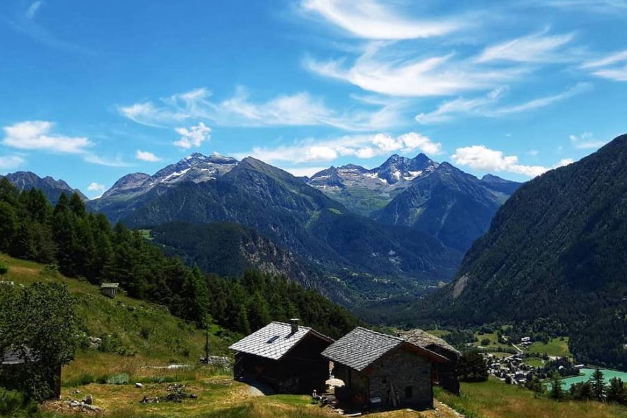
Laghetto di Brusson - Extrepiéraz

Route category:

Duration:

Length: 2915 m

Difficulty:

Laghetto Extrapieraz

Details of the tour

Properties

Ascent: 42 m

Lowest point: 1296 m

Highest point: 1338 m

Distance: 2915 m

Where

Start point

Brusson, 11022 Brusson AO

Get me there

Destination

Brusson - Salomon - Extrepiéraz

Route category:

Duration:

Length: 3995 m

Difficulty:

Extrapieraz

Details of the tour

Properties

Ascent: 340 m

Lowest point: 1363 m

Highest point: 1390 m

Distance: 3995 m

Where

Start point

Brusson, 11022 Brusson AO

Get me there

Destination

Bike itinerary: Le Ponteil - Col d'Arlaz

Route category:

Length: 16630 m

Difficulty:

mountain bike

Details of the tour

Properties

Ascent: 165 m

Descent: 165 m

Distance: 16630 m

Where

Start point

Brusson, 11022 Brusson AO

Get me there

Destination

Bike Itinerary: Circuit Salomon - Col di Joux

Route category:

Length: 14100 m

Difficulty:

mountain bike

Details of the tour

Properties

Ascent: 954 m

Descent: 954 m

Distance: 14100 m

Where

Start point

Laghetto di Brusson, 11022 Brusson AO

Get me there

Destination

Bike Itinerary: Champoluc - Brusson

Route category:

Length: 19290 m

Difficulty:

mountain bike

Details of the tour

Properties

Ascent: 635 m

Descent: 635 m

Distance: 19290 m

Where

Start point

Pra Charbon , 11020 Ayas AO

Get me there

Destination

Bike itinerary: Col de Joux circuit

Route category:

Difficulty:

mountain bike

Details of the tour

Properties

Ascent: 669 m

Descent: 669 m

Where

Start point

Brusson Laghetto, 11022 Brusson AO

Get me there

Destination

Pont de Messuere - Lago Bringuez - Corno Bussola

Route category:

Duration:

Difficulty:

Corno Bussola

Details of the tour

Properties

Ascent: 1600 m

Lowest point: 1425 m

Highest point: 3023 m

Where

Start point

Pont de Messuere, 11022 Brusson AO

Get me there

Destination

Estoul - Mont Bieteron

Route category:

Duration:

Length: 5018 m

Difficulty:

Mont Bieteron

Details of the tour

Properties

Ascent: 881 m

Lowest point: 1884 m

Highest point: 2763 m

Distance: 5018 m

Where

Start point

Estoul, 11022 Brusson AO

Get me there

Destination